
Climate change is no longer a future challenge for cities – it is already shaping urban life today. Heatwaves, heavy rainfall, flooding, and drought are becoming more frequent, putting pressure on urban infrastructure and affecting people’s health and wellbeing. One of the most effective ways cities can adapt is by strengthening urban green infrastructure and ecosystem services it provides.
Green infrastructure (GI) refers to strategically planned network of natural and semi-natural areas that includes green and blue spaces of all types and sizes. GI elements are not just “nice to have” – they perform ecological, as well as social functions essential for well-being of citizens.
Functions that green infrastructure provides, often referred as “ecosystem services” (ES) include:
- cooling the city during summer heat,
- absorbing and slowing down stormwater to reduce flooding,
- improving air quality,
- supporting biodiversity,
- providing spaces for recreation and benefits for the mental wellbeing of people.
What does it mean to map and assess GI and ES?
Mapping GI means identifying where green elements are located across the city and how they are connected. This can include everything from large urban forests and parks to small but important features like roadside trees, green yards or pocket parks. Mapping of the ES mean identifying what services are supplied by which elements and where.
Why is this important for planning of climate change resilient cities?
Mapping of GI and ES provides crucial information for cities in climate adaptation context. First, mapping of GI and ES enables assessing the current situation. By understanding where GI exists already and where it is most needed, city can make several key decisions, including ones that:
- help to protect important GI areas from other development interests by adjusting zoning,
- prioritize greening actions where climate risks are the highest,
- design nature-based solutions and other interventions that help to address real local problems based on data and scientific evidence,
- use limited space and resources more strategically.
In short, assessing green infrastructure and ecosystem services helps cities move from general ambitions to smart, climate-responsive greening. It ensures that Greening Plans are not only about adding more green, but about placing the right green in the right places to support climate adaptation and improve quality of life for everyone.
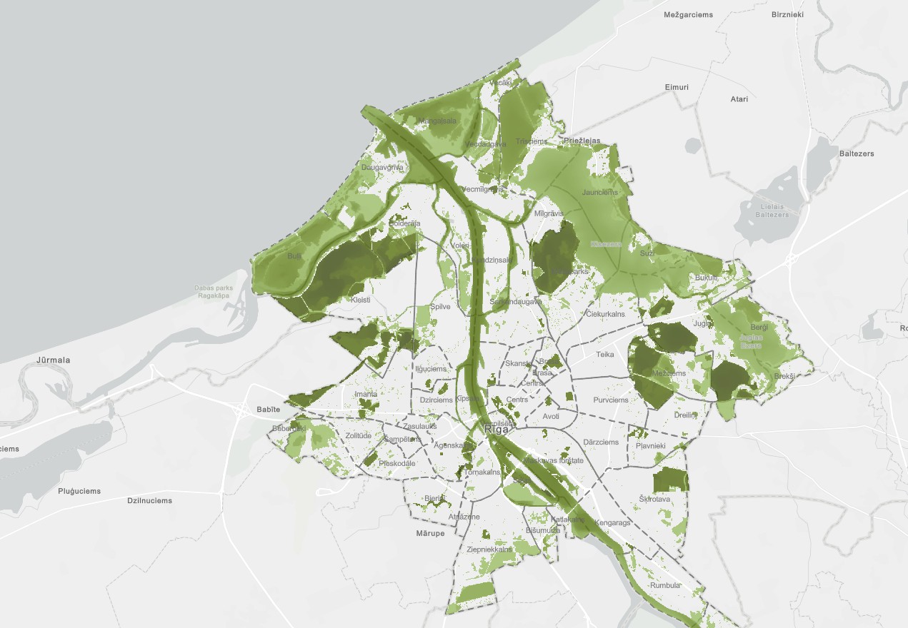
Mapping of green infrastructure and ecosystem services in LIFE LATESTadapt
Within LIFE LATESTadapt project three Latvian cities – Riga, Cēsis and Valmiera – are developing Greening plans with aim to increase their climate resilience. Mapping of GI and ES was performed for all three municipalities by Baltic Environmental Forum – Latvia team in order to provide crucial background information that will help to guide further development of the Greening plans in an evidence-based way. The assessments helped to identify the contribution of existing GI to climate adaptation through the supply of key ES – such as microclimate regulation and regulation of water flows. Assessment of ES also included participatory mapping as urban GI provides a wide range of non-material benefits for the well-being of people or so called “culture ecosystem services”. Furthermore, a prioritization of areas with high risk of flooding and heat island effects were carried out, highlight locations where additional greening measures and nature-based solutions are most needed.
Currently all three cities are doing extensive work to draft their Greening plans that are expected to be finalised by August 2026. Strategic goals and measurable targets, as well as a list of actions and priorities for urban greening, are developed by municipalities based on the results of GI mapping and assessment, as well as proposals form series of expert meetings, stakeholder engagement events, and scenario-building workshops organised by the LIFE LATESTadapt project.
Results on the mapping of ecosystem services and green infrastructure is available in geoportal (in Latvian): https://experience.arcgis.com/experience/5b1e464b657846078fd03eb237d1fc3c/page/Galven%C4%81_lapa?draft=true